Maps by Jay Bowen
Digital Scholarship & Publishing Studio, University of Iowa
Independent Work

US Global Weapons Transfers
A map made from data downloaded from the Stockholm International Peace Research Institute's (SIPRI) Arms Transfers Database of Trend Indicator Values (TIV). These values are based on the known unit production costs of a core set of weapons and are intended
to allow for a common measurement of arms flow trends between nations over time. This map plots trends in arms transfers from the US to other nations between 1950 and 2023.

The Adirondack High Peaks in 3D, 1899
This web map application leverages DSM raster elevation data stored in PMTiles to give 3-dimensional relief to an 1899 topographic map of the Adirondack High Peaks near Lake Placid, NY. Hillshading was done in Blender and coding performed primarily with MapLibre GL JS. All techniques used are free and open-source.

CSV-2-Storymap
A small web map application that turns your formatted CSVs into story maps that your can download and host. No subscriptions, licenses, fees, or GIS knowledge needed.
Collaborations with Students & Friends

Mapping the Home Insurance Crisis
An interactive map exploring the costs of climate change through rising insurance premiums, policy nonrenewals, cancellations, and claims. This map measures and presents these metrics by zip code across the nation and is powered by MapLibre GL Js and PMTiles.

Women Scientists in Pre-War Tokyo
This project is an attempt to undo the erasure of women scientists and affirm their contributions to science in early twentieth-century Japan. Although the government was not active in promoting women/'s higher education and training women scientists, ambitious women and their supporters created spaces where women could engage in scientific inquiry. By mapping these sites and naming the women scientists associated with them, this project demonstrates that women were part of the development of modern science in Japan. This was a collaboration with Lisa Nakahara.
Collaborations with Faculty & Staff

Genetic Privacy Laws in the USA (In Progress)
This map is a collaboration with the University of Iowa College of Law to map the current state-by-state legal landscape of genetic privacy laws across the United States.
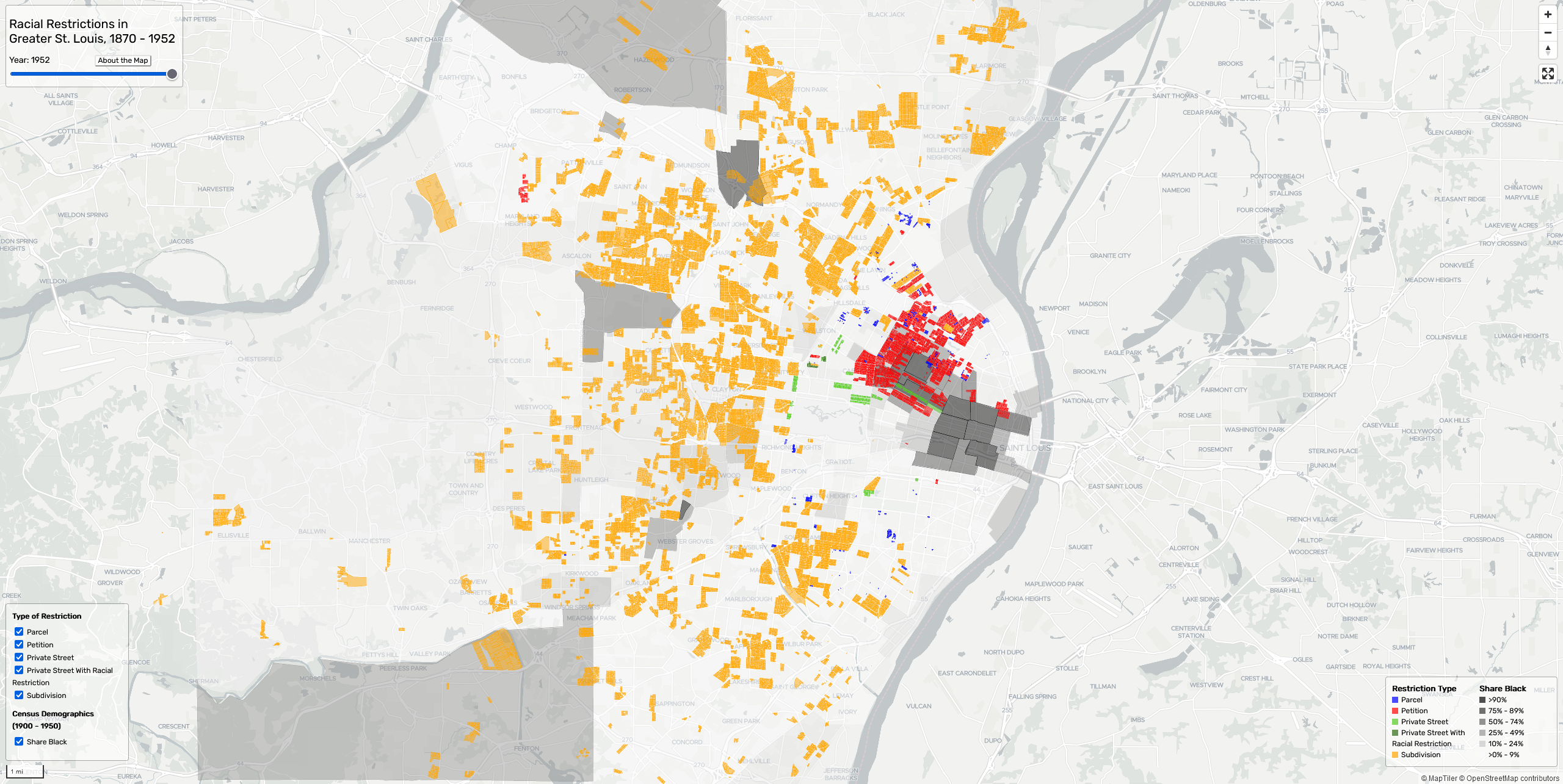
Racial Restrictions in Greater St. Louis: 1870-1952
This web map application maps 763 unique restrictive covenants or agreements (totaling 29,947 residential parcels) enacted in the City of St. Louis and 1,041 unique restrictive covenants or agreements (totalling 75,539 parcels) enacted in St. Louis County between 1870 and 1952. This was a collaboration with Colin Gordon, PhD.
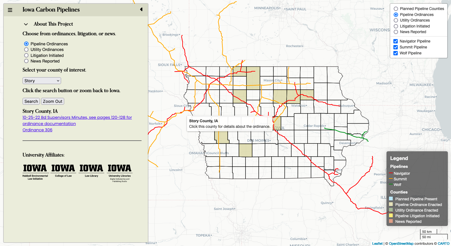
Iowa Carbon Pipelines: Ordinances, Litigation, and News
This map helps users locate Iowa counties impacted by planned carbon pipeline construction, ordinances, litigation, and news. Research for this project was conducting by staff and research assistants of the Hubbell Environmental Law Initiative at the University of Iowa College of law. This application was developed by the University of Iowa Libraries' Digital Scholarship & Publishing Studio. The locations of the planned pipelines were digitized by researchers at the FracTracker Alliance and appear here courtesy of Dr. Ted Auch, the Midwest Program Director of the FracTracker Alliance.
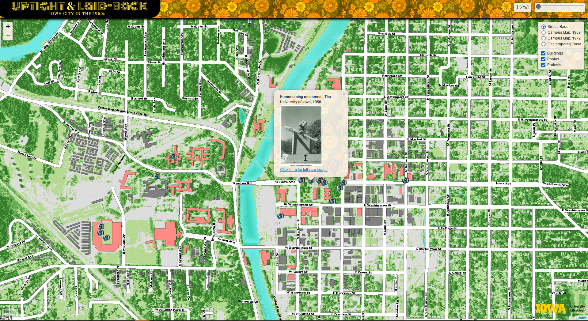
Uptight & Laid-Back: Iowa City in the 1960s
A web map application showing events in the history of the University of Iowa between 1958 and 1975.
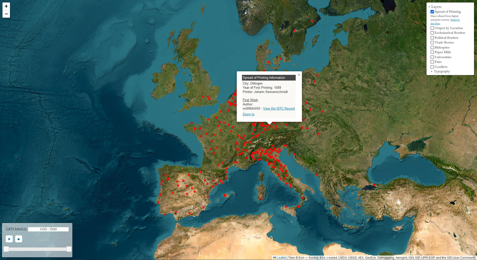
Atlas of Early Printing
This is a map application showing major advances in printing alongside religious, political, economic, and cultural developments in the late 15th century.
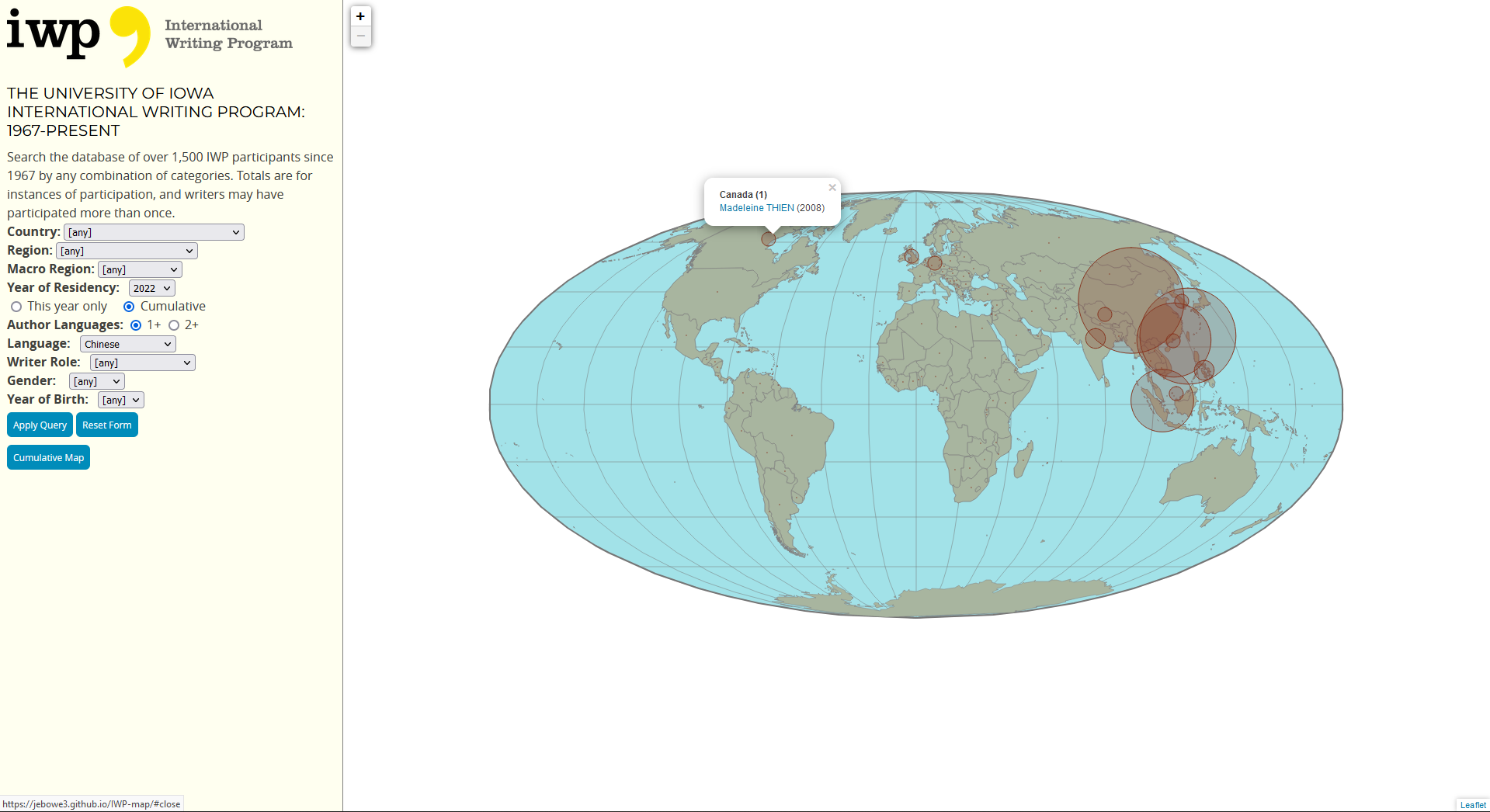
International Writing Program Participants
A searchable and filterable database of over 1,500 University of Iowa International Writing Program participants since 1967.
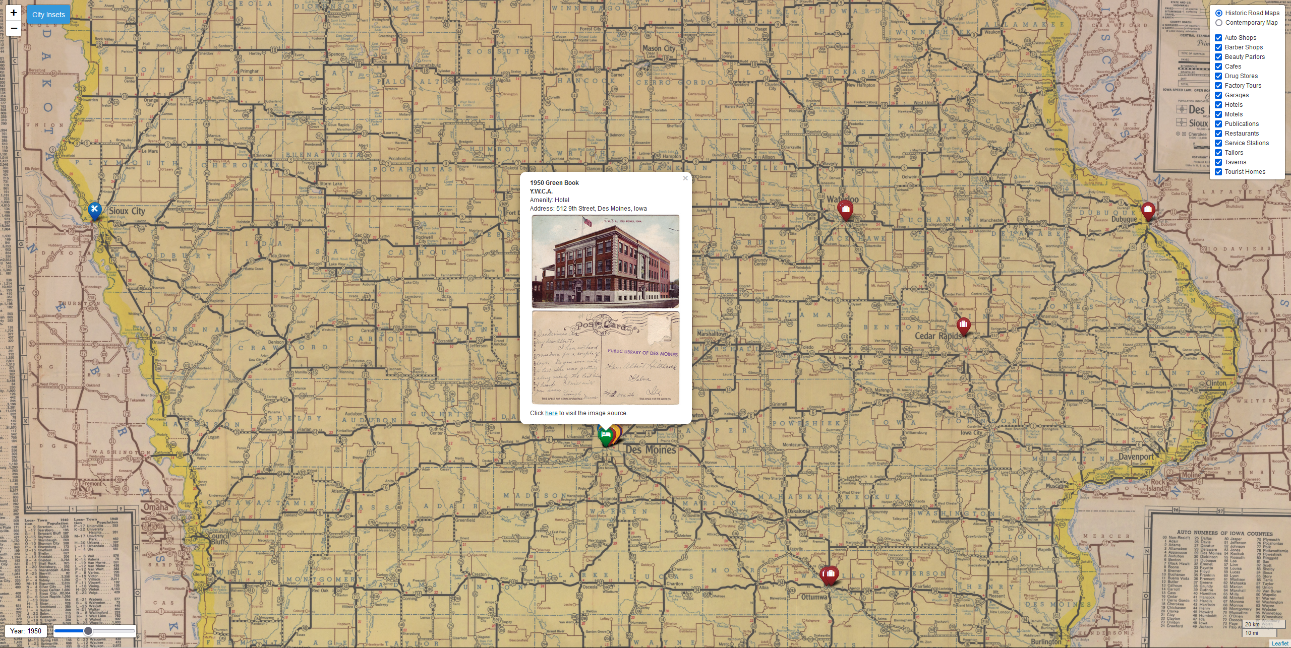
Tour Mid-Twentieth Century Iowa Green Books
Victor Hugo Green, a New York postal employee, founded the Negro Motorist Green Book in 1936 and published it annually for 30 years. The publication was an indispensable tool for Black motorists in the U.S., who navigated through a segregated nation during the Jim Crow era. The guide included information about restaurants, lodging, and other services considered hospitable to Black travelers. Establishments in Iowa were among those listed in the Green Book, identified in the linked interactive map. This was a collaboration with David McCartney.

